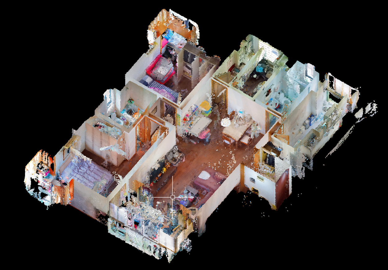
01ACTUAL CAPTURED POINT CLOUD
Record the existing space
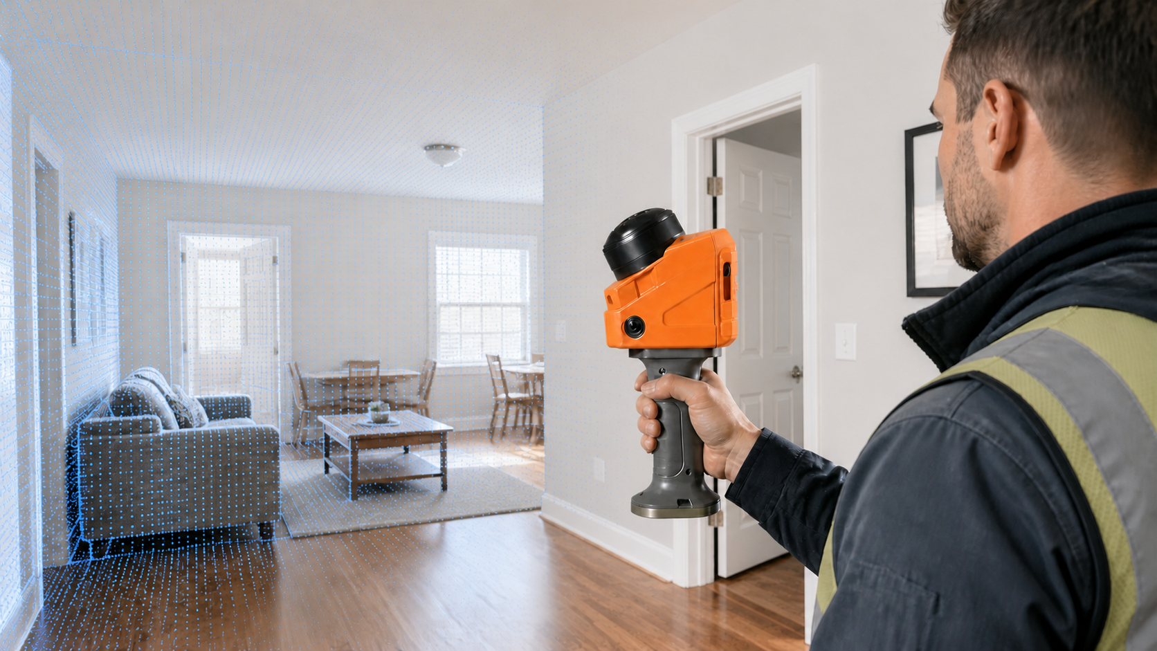
A handheld laser scanner records visible building geometry. The captured point cloud provides spatial evidence for drawing production.
OUR CAPTURE & DRAWING WORKFLOW
A scanner records the building. Our production team turns that record into practical existing-condition documentation. See how handheld laser capture, point-cloud processing and Human QA work together.
ONE PROJECT · THREE PRODUCTION STAGES
These samples show the same residential project: actual captured point-cloud data, an auto-generated first draft, and the reviewed drawing sample. A handheld laser scanner captures the geometry; people prepare and check the final drawings.
01ACTUAL CAPTURED POINT CLOUD
A handheld laser scanner records visible building geometry. The captured point cloud provides spatial evidence for drawing production.
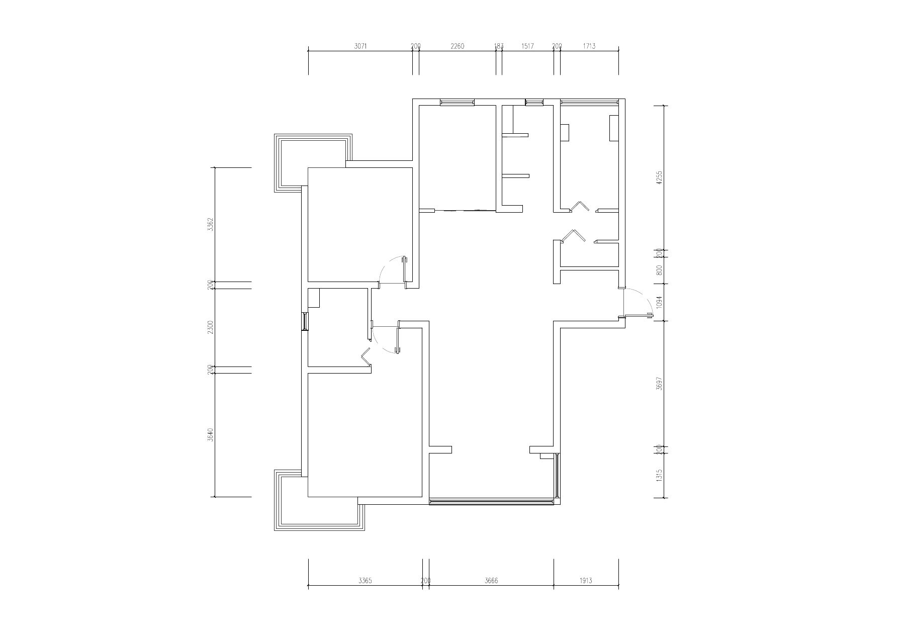
02AUTO DRAFT · BEFORE HUMAN REVIEW
Automated drafting creates an initial drawing for production. This screenshot is an unchecked intermediate stage, not the final deliverable.
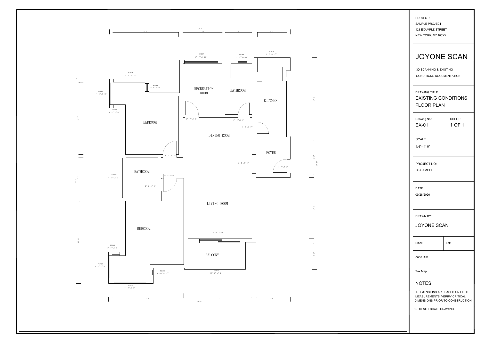
03REVIEWED CAD SAMPLE · PDF + DWG
The production team interprets the site information and reviews the drawing before delivery. See the supplied reviewed PDF sample and original DWG below.
Automation is a production step, not the final deliverable. The auto draft and reviewed sample show different stages of the workflow. The point cloud supports our CAD production; your Digital Site is provided separately for 360° visual review.
SEE THE DRAWING BEFORE YOU REQUEST A QUOTE
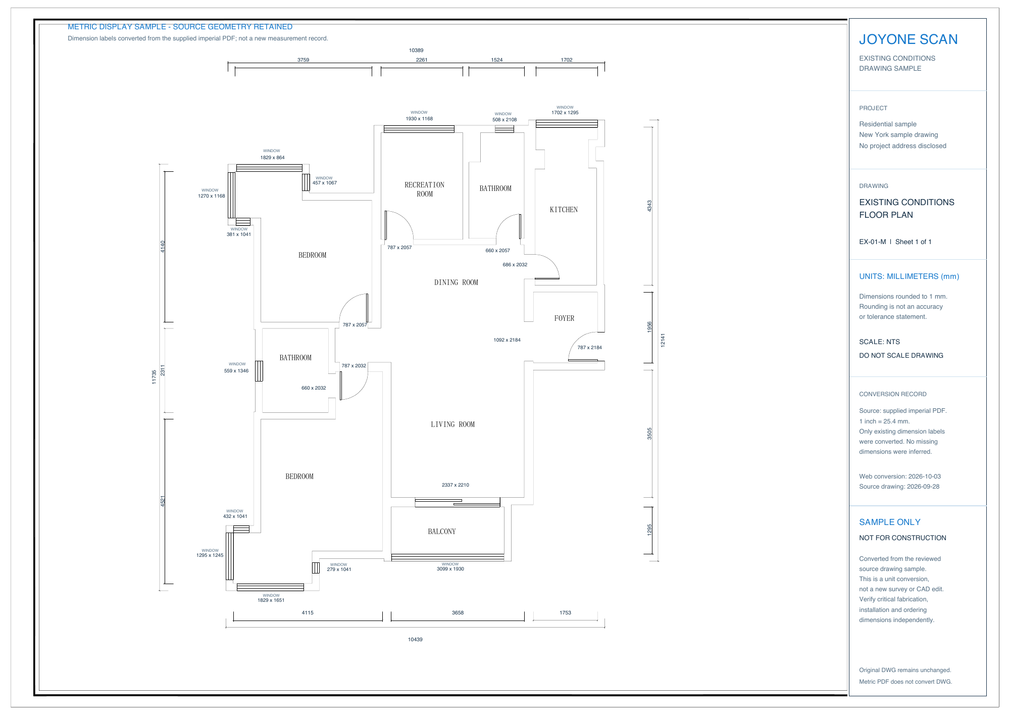
See walls, openings, room labels and dimension annotations in the reviewed existing-condition sample. Both PDF unit versions are available; the original DWG is unchanged.
Choose the sample format that fits your workflow. Confirm the required drawing units with us when requesting a project quote.
The metric PDF converts the existing imperial annotations to whole millimeters; it is not a new measurement record or a metric DWG. Rounding does not indicate measurement accuracy. The original DWG retains its source units.
Sample only · not for construction. Critical fabrication, installation and ordering dimensions require independent field verification where needed.
Get a quote for your property ↗HANDHELD LASER SCANNING
The useful result comes from the complete workflow. Laser geometry, motion alignment, visual reference and drawing review each contribute different information.
Laser observations record visible surfaces, creating spatial information that supports interpretation of walls, rooms and openings within the agreed capture area.
SLAM estimates movement and aligns observations collected along the scan route. Coverage and alignment are reviewed as part of spatial data processing.
Site imagery supports interpretation of captured conditions. Separately prepared 360° imagery gives clients a browser-accessible Digital Site for visual review.
Data-driven drafting supports production efficiency. People interpret the building, prepare the agreed CAD scope and review the drawings before DWG and PDF delivery.
CHOOSING A CAPTURE METHOD
Manual measurements remain useful for a small number of dimensions or critical checks. Laser capture adds value when a project needs a coordinated record of many visible existing conditions.
| Project need | Manual measurement | Handheld laser capture |
|---|---|---|
| A few specific dimensions | Often a practical, focused approach. | Useful when broader spatial documentation is also needed. |
| Multiple rooms and openings | Dimensions, notes and photos are collected individually. | Records a connected spatial dataset for drawing production. |
| Questions after the visit | Answers depend on what was measured and recorded. | Captured data may support another dimension check, subject to visibility and quality. |
| Critical trade dimensions | Targeted field checks can be used for the required task. | Renovation-grade documentation; independent field verification remains necessary where required. |
HUMAN QUALITY CONTROL
Scanner specifications describe the equipment. Final drawings also depend on how the property is captured, how the data is processed and how the building is interpreted.
TECHNOLOGY QUESTIONS
A handheld laser scanner records distances to visible surfaces while an operator moves through a building. SLAM—simultaneous localization and mapping—estimates the scanner’s movement and aligns successive observations into a spatial dataset. The resulting point cloud supports existing-condition drawing production.
A handheld laser scanner records visible building geometry for drawing production. Capture is one stage of the service: spatial data is processed, the agreed CAD drawings are prepared, and people review the deliverables before delivery.
No. Laser scanning records spatial geometry. Site imagery helps the team understand visible materials, openings and other site details. Geometry and imagery complement each other but serve different purposes.
A point cloud is a collection of spatial points representing captured surfaces. JoyOne Scan uses processed spatial data for CAD production and supported dimension checks. Standard delivery includes the agreed drawings and browser-based 360° Digital Site access; raw point-cloud delivery is not a standard inclusion.
No. Device specifications describe performance under defined conditions. Final drawing quality also depends on scan coverage, operator workflow, alignment, obstructions, site geometry, data processing and human review. The project scope defines what is documented.
The Digital Site provides browser-based 360° visual site review. The platform also supports point-cloud measurement when enabled in the project share; available views, tools and units are confirmed in the project scope. Send JoyOne Scan the location or dimension you need; we can check it where captured visibility and data quality support a reliable confirmation.
No. Critical construction, fabrication, installation and ordering dimensions should be independently field-verified where required. Hidden or inaccessible conditions need a separate investigation. Our standard service is renovation-grade existing-condition documentation.